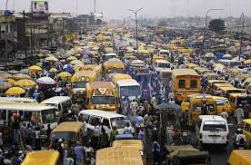
In the past few years, economic losses due to natural and man-made hazards such as flood, pipeline vandalism, building collapse, oil and gas explosion, have increased. Some buildings collapse with their occupants trapped in them while others are gutted by fire, leaving casualties in their wake.
No fewer than 23 persons died from the pipeline explosion in Abule Ado in Lagos, not long ago; scores were injured and well over 50 buildings were either destroyed or damaged in the blast. This was according to the National Emergency Management Agency (NEMA). Rev. Sister Henrietta Alokha, the Principal of the Bethlehem Girls College lost her life while trying to rescue students of the school whose buildings was engulfed by the fire.
The Lagos State Government and the Nigerian National Petroleum Corporation (NNPC) official statements confirmed that the explosion occurred when an articulated vehicle transporting fuel got stuck while trying to enter a particular street. And in the process of getting out, it made contact with NNPC pipelines within that corridor which led to the explosion. There were reports that the articulated vehicle which usually conveyed the product, may have belonged to a gas processing plant in that area.
It is clear that a cocktail of issues does not quite conduce to the safety of persons and buildings in that environment. The same is the case in some parts of Lagos and other places in the country where pipeline fire incidents are fairly frequent and have also resulted in fatalities. Earlier this year in Kaduna state, there was an explosion that took the life of an atomic energy expert.
Disasters of this nature pose serious challenge to the Nigerian economy with direct consequences of migration, epidemic, job loss, among others.
Part of the problem is the co-location of industrial and semi-industrial activities in residential areas in clear violation of the Right of Way guidelines. Available statistics from the Office of the Surveyor General of the Federation indicate that for any environment, the rights of way are usually stipulated. The Office draws a rundown of the designated right of way for some infrastructure across the country: for Federal Government roads, the right of way is about 45.72 metres; gas pipeline is about 12.5 metres on either side which gives 25 metres right of way; water and sewage is about 3.81 metres; high tension for 132kva is about 15 metres on either side which is 30 metres; 330kva is about 50 metres; 760kva is about 42.5 metres which gives about 85 metres right of way.
Read Also: Special Status for Lagos: In Whose Interest?
The purpose of right of way is to create access for relevant authorities in case of catastrophes so that the people as well as infrastructure can be secure. Regrettably, right of way has been sufficiently abused in many built environments in the country because urban planners have failed to enforce compliance. Structures are now put up in right of way even though the cost of destroying such structure or any loss that might be incurred, is borne by property owner. Assessing disaster sites have become problematic. Many markets are not fire-compliant, and fire service authorities find it difficult to access disaster sites to bring infernos under control.
It is instructive to state that most of the towns in the country were well planned even before the colonial times. A lot of the cities had general plans and masterplans to guide development. Records show that town planning or regional planning started at least 300 years before the arrival of the British. Before that time, the Portuguese had been to the Benin Empire and found that there was no city as better planned as Benin city in the 15th century.
In recent history, these laudable achievements have been undermined by a plethora of issues. The Federal Capital Territory (FCT) can be used as a pointer to the disorderliness that takes place in some other towns in the country. From inception though, every square inch of the 250 square.km land of the FCT was planned. The planning was supposed to be systematic; development was supposed to start from phases one, two, three, four and now phase five. But the development process was not systematic.
The movement of the seat of government from Lagos to Abuja was supposed to be systematic but it was not. It was hurriedly done. As a result, certain policies that are not supposed to be implemented are now receiving approval. That is why there are issues of squatter settlements and unauthorised developments springing up by the day. Also, the resettlement programme has not been systematic as planned because some indigenous settlements have not been moved to where they should be, with many pedestrian walkways in the Federal Capital Territory being turned into parking lots.
Nevertheless the FCT has a good document that is supposed to guide the coordination of the activities in the city and also serve as a model for sub-national entities. But the FCT lacks up to date maps to work on. Therefore, it’s difficult to have current planning, and if there is planning at all, there are always issues of inadequate funding, and lack of equipment. There is also the absence training and retraining programmes to retain manpower and to implement the FCT plans. If an environment is not mapped, it cannot be well managed. It is said that the Department of Development Control, the organ statutorily responsible for enforcement of development, also has limited capacity to carry out enforcement through the FCT.
Authorities have disclosed that the last time the FCT had a base map was in the 90s. It is hoped that the current effort by the Director of Survey and Mapping in the FCT to get an up to date base map will be successful. With that, the city can monitor implementation, its settlements and plans.
Sometimes, there are areas designated for residential, light industries, heavy industries, among others. But you find that even within the residential areas, there are factories which put a lot of pressure on the limited utilities and facilities which have been provided based on a given population.
That is why there is epileptic power supply. It is the reason why pipes provided for sewers are clogged; people resort to boreholes because public water supply has been converted to industrial use.
There are low density, medium density and high density areas but people change these land uses at will. In the FCT for instance, streets like Adetokunbo Ademola, Ladoke Akintola, Aminu Kano Crescent; Usman and Gana streets in Maitama, are purely low density areas but they have been converted into other uses hence the heavy traffic build-ups that are noticed in some of these areas.
In some saner climes, if a garden is to be converted into other uses, consent of neighbours will be sought, and if they don’t approve, you don’t convert. In Nigeria, there are enough plans and laws but they suffer enforcement glitches partly because some enforcement agencies are compromised. Many times when underground cables are dug, they disrupt water and energy supply, among others, and officials look the other way. The underground engineering cadastral maps for water, that show connection points in the FCT are largely disregarded.
Authorities have made efforts to disabuse the minds of people about the existence of silos mentality among the different professional bodies. For instance, the Surveyor General’s office wrote a memo to the Federal Executive Council (FEC) in 2005. One of the conclusions of the Council was the approval of the office as an Extra-Ministerial Department which empowers it to have units in water resources, works and housing, transportation, environment, and other human activities and development purposes. This is in addition to the monthly Technical Coordination Committee meetings chaired by the executive secretary of the FCDA, and attended by stakeholders in technical departments for planning, engineering, survey and mapping, land, fire service, water board, among others.
These are huge claims of purported right linkage among relevant agencies that are involved in urban planning and the people who are the end-users of the products of their interaction. What cannot be denied is the existence of urban chaos with disasters in several locations throughout the country. Buildings come down, and everybody goes on blame shopping. If an area is designated a new city, before long, everything is overrun.
Fire hydrants in communities are almost non-existent. What we find especially in the FCT is that the fire truck is accompanied by a water tanker which is also painted in the colours of the fire service to provide water even though the capacity of the water tanker cannot take much. This calls to question whose duty it is to construct or designate the location for fire hydrants. Clearly, this cannot be the objective of agencies that are working with collaboration in mind.
All these factors suggest that the authorities do not to have a clear sense of how to control our layouts. It is really an anguish that seems to have no solution in sight. It is evident that very important aspects of disaster management effort in the country including risk assessment and crowd control have been ignored in ensuring sustainable regional development.
In disaster prevention and management, attention ought to be paid to calamities by using geo-spatial technology and remote sensing mechanisms. These can centralise and visually display critical information during an emergency; they can be versatile tools in building capacity for disaster reduction and preparedness. Geo-spatial information can help in taking evidence-based decisions.
There is a feeling in certain quarters that the UN has instructed that every activity in the 17 agenda of the SDGs has to be integrated with surveying and mapping if the 2030 objective will be realised. The onus now lies on the relevant authorities to be up to the task in the attainment of such goal.
Moses AMADI
Researcher, biographer and media Entrepreneur, lives in Lagos

